Skip to search
Skip to main content
Skip to first result
Search
You Searched For
Subject (Geographic)
Nevada--Maps
Search Results
Creator:
Published / Created:
1863
Call Number:
844 1863
Container / Volume:
BRBL_00602
Image Count:
1
Resource Type:
Maps, Atlases & Globes
Description:
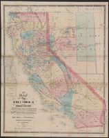
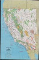
"Entered according to act of Congress in the year 1863 by Warren Holt ...."
Publisher:
W. Holt,
Subject (Geographic):
California--Maps and Nevada--Maps
Subject (Name):
Doolittle, A. J and Holt, Warren
Subject (Topic):
Mining districts--California--Maps and Mining districts--Nevada--Maps
Found in:
Beinecke Rare Book and Manuscript Library > A new map of the state of California and Nevada Territory : exhibiting the rivers, lakes, bays and islands, with the principal towns, roads, railroads, and transit routes to the silver mining districts of Nevada Territory ... / carefully compiled ... by L
Creator:
Published / Created:
1870
Call Number:
844 1870
Container / Volume:
BRBL_00602
Image Count:
1
Resource Type:
Maps, Atlases & Globes
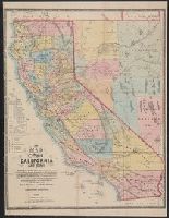
Description:
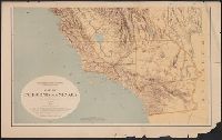
"Entered according to Act of Congress in the year 1869 by Warren Holt, in the clerk's office of the District Court of the Northern District of the state of California."
Publisher:
W. Holt,
Subject (Geographic):
California--Maps and Nevada--Maps
Subject (Name):
Holt, Warren
Subject (Topic):
Mining districts--California--Maps and Mining districts--Nevada--Maps
Found in:
Beinecke Rare Book and Manuscript Library > A new map of the states of California and Nevada : exhibiting the rivers, lakes, bays, and islands, with the principal towns, roads, railroads and transit routes to the silver mining districts of Nevada Territory, also meridian, standard, range and townsh
Creator:
Published / Created:
1867
Call Number:
844 1867
Container / Volume:
BRBL_00602
Image Count:
1
Resource Type:
Maps, Atlases & Globes
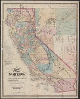
Description:
"Entered according to Act of Congress in the year 1869 by WarrenHolt, in the clerk's office of the District Court of the Northern District of the state of California."
Publisher:
W. Holt,
Subject (Geographic):
California--Maps and Nevada--Maps
Subject (Name):
Baker, Geo. H. (George Holbrook), 1827-1906, Doolittle, A. J, and Holt, Warren
Subject (Topic):
Mining districts--California--Maps and Mining districts--Nevada--Maps
Found in:
Beinecke Rare Book and Manuscript Library > A new map of the states of California and Nevada : exhibiting the rivers, lakes, bays, and islands, with the principal towns, roads, railroads, and transit routes to the silver mining districts; also meridian, standard, range and township lines as establi
Creator:
Published / Created:
1984
Call Number:
80 1984
Container / Volume:
BRBL_00536
Image Count:
2
Resource Type:
Maps, Atlases & Globes
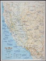
Description:
Ancillary maps on verso : 1. Spanish imprint, 1697-1823 -- 2. Sudden transition, 1821-1860 -- 3. The new Eden, 1860-1900 -- 4. Water, the key to growth, 1900-1940 -- 5. Explosive growth, 1940-present. Inset:
Publisher:
National Geographic Society,
Subject (Geographic):
California--Maps and Nevada--Maps
Found in:
Beinecke Rare Book and Manuscript Library > Far West / produced by the Cartographic Division, National Geographic Society.
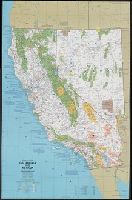
Creator:
Published / Created:
1874
Call Number:
844 1874
Container / Volume:
BRBL_00602
Image Count:
2
Resource Type:
Maps, Atlases & Globes
Description:
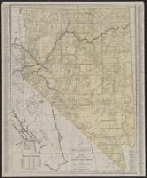
Relief shown by shading.
Publisher:
Regents of the University of California,
Subject (Geographic):
California--Maps and Nevada--Maps
Subject (Name):
Bien, Julius, 1826-1909, Craven, Alfred, Geological Survey of California, Hoffmann, C. F. (Charles Frederick), 1838-1913, and University of California (1868-1952). Regents
Found in:
Beinecke Rare Book and Manuscript Library > Map of California and Nevada / State Geological Survey of California ; drawn by F.v. Leicht and A. Craven.