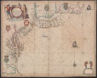
Appears in: John Seller, Atlas maritimus, 1675 (McCorkle 36)., Depths shown by soundings in Chesapeake Bay and south to Cape Hatteras., Includes decorative cartouche, coats of arms, and other ill. Lower right corner: empty cartouche., and Mounted on linen. Verso
Subject (Geographic):
Middle Atlantic States--Nautical charts--Early works to 1800 and New England--Nautical charts--Early works to 1800