BEIN 2003 Folio 85: Without book of directions mentioned after publisher statement. No. 10 of 45 maps bound together with binder's spine title: Atlas of America; ms. table of contents. Bookplate: Robinson. Bookplate of Paul Mellon.
Publisher:
Published ... by James Cook, and sold by I. Mount and T. Page ... Tho's. Jeffrey ... and And'w. Dury ... London
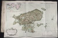
Carte d'une partie de l'isle de Terre Neuve et les isles de St. Pierre et Miquelon [scale ca. 1:666,666].
Description:
BEIN 2003 Folio 85: No. 12 of 45 maps bound together with binder's spine title: Atlas of America; ms. table of contents. Bookplate: Robinson. Bookplate of Paul Mellon.
Publisher:
Dépost des cartes et plans de la marine
Subject (Geographic):
Saint Pierre and Miquelon and Newfoundland and Labrador
Pencil, pen and ink, pen and wash, and watercolor illustrations in a sketchbook, unsigned, by an unidentified artist of Ontario and Québec, Canada, circa 1808. Depicted are Newfoundland, “carrioles [sic] (carriages) of lower Canada”, “sledge of lower...
Description:
Manuscript captions in English.
Subject (Geographic):
Canada, Champlain, Lake, Erie, Lake, Fort Chambly (Chambly, Québec), Fort Saint Joseph National Historic Site (Ont.), Thunder Bay (Ont.), Huron, Lake (Mich. and Ont.), Montmorency River (Québec), Newfoundland and Labrador, Old Fort William (Thunder Bay, Ont.), Ontario, Ottawa River (Québec and Ont.), Québec (Québec), and Sainte-Hélène Island (Québec)