Skip to search
Skip to main content
Skip to first result
Search
You Searched For
Subject (Geographic)
Northeastern States--Maps
Search Results
Creator:
Published / Created:
Dec. 1st 1807.
Call Number:
73 1807
Container / Volume:
BRBL_00374
Image Count:
1
Resource Type:
Maps, Atlases & Globes
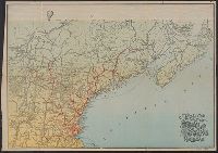
Description:
Also covers the northeastern United States.
Publisher:
Published by J. Cary, engraver & map-seller, No. 181 Strand,
Subject (Geographic):
Northeastern States--Maps, Ontario--Maps, and Québec (Province)--Maps
Found in:
Beinecke Rare Book and Manuscript Library > A new map of Upper & Lower Canada / from the latest authorities by John Cary, engraver.
Creator:
Published / Created:
[1796]
Call Number:
755 1796B
Container / Volume:
BRBL_00436
Image Count:
1
Resource Type:
Maps, Atlases & Globes
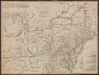
Description:
Includes historical notes, text, 3 distance charts, and inset, "A sketch of the remaining part of Ohio R. &c."
Publisher:
Printed for the proprietors, Bowles & Carver, No. 69 in St. Paul's Church Yard, London,
Subject (Geographic):
Canada--Maps--Early works to 1800 and Northeastern States--Maps
Subject (Name):
Bowles & Carver
Found in:
Beinecke Rare Book and Manuscript Library > Bowles's new one-sheet map of the independent states of Virginia, Maryland, Delaware, Pensylvania, New Jersey, New York, Connecticut, Rhode Island, &c. : comprehending also the habitations & hunting countries of the confederate Indians / by Lewis Evans.
Published / Created:
[186-]
Call Number:
754gme 1867
Container / Volume:
BRBL_00420
Image Count:
1
Resource Type:
Maps, Atlases & Globes
Description:
Shows [T]runk lines in operation, constructing, and surveyed and ready for constructing, branches in operation, branche [sic] connections contemplated, and Erie railway and coal lines.
Publisher:
J.H. Buffordis, lith.,
Subject (Geographic):
Northeastern States--Maps
Found in:
Beinecke Rare Book and Manuscript Library > Map of the Boston, Hartford & Erie Rail Road.
Published / Created:
[186-]
Call Number:
754gme 1867A
Container / Volume:
BRBL_00420
Image Count:
1
Resource Type:
Maps, Atlases & Globes
Description:
Shows rail lines between Lake Erie and Boston Harbor, hand colored.
Publisher:
s.n.,
Subject (Geographic):
Northeastern States--Maps
Found in:
Beinecke Rare Book and Manuscript Library > Map of the Boston, Hartford & Erie Rail-Road.
Creator:
Published / Created:
1871
Call Number:
753gme 1871
Container / Volume:
BRBL_00415
Image Count:
1
Resource Type:
Maps, Atlases & Globes
Description:
"Entered according to Act of Congress in the year 1871 by G.W. & C.B. Colton & Co. in the Office of the Librarian of Congress, at Washington."
Publisher:
G.W. & C.B. Colton & Co.,
Subject (Geographic):
Northeastern States--Maps
Found in:
Beinecke Rare Book and Manuscript Library > Map showing the route of the Canada Southern Railway : and its connecting lines / prepared by G.W. & C.B. Colton & Co.
Creator:
Published / Created:
[1890?].
Call Number:
753gme 1890
Container / Volume:
BRBL_00415
Image Count:
1
Resource Type:
Maps, Atlases & Globes
Description:
Color illus. across head of map.
Publisher:
Rand Avery Supply Co. ,
Subject (Geographic):
Northeastern States--Maps
Found in:
Beinecke Rare Book and Manuscript Library > Tourist map of the Boston and Maine Railroad.