Skip to search
Skip to main content
Skip to first result
Search
You Searched For
Subject (Geographic)
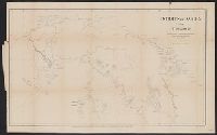
Panama--Maps
Search Results
Published / Created:
1849
Call Number:
898 1849
Container / Volume:
BRBL_00660
Image Count:
1
Resource Type:
Maps, Atlases & Globes
Publisher:
Hydrographic Office of the Admiralty,
Subject (Geographic):
Panama--Maps
Found in:
Beinecke Rare Book and Manuscript Library > Central America Panama Railroad. Surveyed by Col. CW Hughes ...
Published / Created:
1867]
Call Number:
89 1866I
Container / Volume:
BRBL_00658
Image Count:
1
Resource Type:
Maps, Atlases & Globes
Description:
From: Charles H. Davis' Report on interoceanic canals and railroads between Atlantic and Pacific Oceans. 1867, no. XIII.
Publisher:
Govt. Printing Office,
Subject (Geographic):
Panama--Maps
Subject (Name):
United States Naval Observatory
Found in:
Beinecke Rare Book and Manuscript Library > Isthmus of Darien from 77⁰20' to 80⁰10'. : Compiled at the U.S. Naval Observatory, from various authorities, including maps of 1764.
Published / Created:
1864]
Call Number:
89 1866C
Container / Volume:
BRBL_00658
Image Count:
1
Resource Type:
Maps, Atlases & Globes
Description:
"No. VII." in upper right margin.
Publisher:
Govt. Printing Office,
Subject (Geographic):
Panama--Maps
Found in:
Beinecke Rare Book and Manuscript Library > Map and profile of the route for the construction of a ship canal between the Pacific and Atlantic oceans / A McDougal, Chief Engineer, C.A. Sweet Principal Ass't.
Creator:
Published / Created:
1867]
Call Number:
89 1866B
Container / Volume:
BRBL_00658
Image Count:
1
Resource Type:
Maps, Atlases & Globes
Description:
"To accompany Report of Rear Admiral C. H. Davis, U.S.N., ordered by Resolution of the Senate of the United States of March 19, 1866.
Publisher:
Govt. Printing Office,
Subject (Geographic):
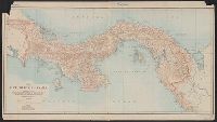
Panama Canal (Panama)--Maps and Panama--Maps
Subject (Name):
Bowen & Co, Davis, Charles Henry, 1807-1877, Hergesheimer, E. (Edwin), and Panama Railroad Co.--Maps
Subject (Topic):
Canals--Panama--Maps and Railroads--Panama--Maps
Found in:
Beinecke Rare Book and Manuscript Library > Map of the Isthmus between Chagres and Panama : (Panama Rail Road added.) / by Chief Engineer Napoleon Garella, 1845; drawn by E. Hergesheimer.
Creator:
Published / Created:
[1904]
Call Number:
898 1904
Container / Volume:
BRBL_00660
Image Count:
1
Resource Type:
Maps, Atlases & Globes
Description:
Depths shown by soundings.
Publisher:
General Staff,
Subject (Geographic):
Panama--Maps
Found in:
Beinecke Rare Book and Manuscript Library > Map of the Republic of Panama / prepared in the War Department, Office of Chief of Staff, Second (Military Information) Division, General Staff, U.S.A., Jan. 1904 ; Chas. H. Ourand & D.H. Blakelock, del.
Published / Created:
1913
Call Number:
899 1913
Container / Volume:
BRBL_00660
Image Count:
1
Resource Type:
Maps, Atlases & Globes
Description:
"Canal Data" text at bottom of sheet.
Publisher:
Bormay & Co.,
Subject (Geographic):
Canal Zone--Maps and Panama--Maps
Found in:
Beinecke Rare Book and Manuscript Library > Map showing the Panama Canal and Canal Zone.
Creator:
Published / Created:
1825
Call Number:
85 1825A
Container / Volume:
BRBL_00638
Image Count:
1
Resource Type:
Maps, Atlases & Globes
Alternative Title:
Map of the West Indies, and history of piracies committed on American seamen & commerce
Description:
Over map title: "To the Gallant OFFICERS and SEAMEN of the American navy, the protection of our commerce in the West India Seas this Map is respectfully inscribed by the Publishers," illustration of ships at sea.
Publisher:
Monson & Co. Publishers,
Subject (Geographic):
Caribbean Sea--Maps, Colombia--Maps, Florida--Maps, Guatemala--Maps, Panama--Maps, West Indies, British--Maps, West Indies, French--Maps, and West Indies--Maps
Subject (Name):
Allen, William H.,---1822, Converse, Sherman, 1790-1873, and Monson and Co
Subject (Topic):
Cities and towns--West Indies--Maps and Pirates--West Indies--Maps
Found in:
Beinecke Rare Book and Manuscript Library > West Indies : from the latest and best authorities / engraved by N. & S.S. Jocelyn.
Published / Created:
1913].
Call Number:
897fda 1913
Container / Volume:
BRBL_00659
Image Count:
1
Resource Type:
Maps, Atlases & Globes
Description:
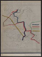
Boundary lines noted in hand-colored ink.
Publisher:
s.n.,
Subject (Geographic):
Costa Rica--Maps and Panama--Maps
Found in:
Beinecke Rare Book and Manuscript Library > [Map illustrating Costa Rica-Panama boundary dispute].