Forty-two new maps of Asia, Africa, and America ... : all engrav’d, according to the latest
Image Count:
1
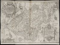
Alternative Title:
A chart of the coasts of Peru, &c
Description:
In pencil on verso: 29. and Table of contents for maps 2-20 in section "America" misnumbered.
Subject (Geographic):
Darien (Panama and Colombia) --Early works to 1800, Peru --Maps --Early works to 1800, Popayan (Colombia), Quito (Ecuador) --Maps, and South America --Maps --Early works to 1800
Forty-two new maps of Asia, Africa, and America ... : all engrav’d, according to the latest
Image Count:
1
Alternative Title:
Peru, and the country of the Amazons
Description:
In pencil on verso: 28. and Table of contents for maps 2-20 in section "America" misnumbered.
Subject (Geographic):
Amazon River Region --Maps --Early works to 1800, La Plata (Argentina) --Maps, Peru --Maps --Early works to 1800, and South America --Maps --Early works to 1800
... Iohn Hvighen van Linschoten. his Discours of Voyages into ye Easte & West Indies. Deuided into
Image Count:
1
Description:
[Scale ca. 1:19,000,000]., Bound in following p. 216., In ink on verso: "197" in upper left corner, which has also been crossed out in ink with three lines., Map has been repaired with tape on verso., Map has one vertical tear just left of center., Map has several small brown and yellow marks that can be seen mostly on verso., and Map properly belongs to the Dutch edition of 1596.
Subject (Geographic):
Brazil --Maps --Early works to 1800, Chile --Maps --Early works to 1800, Cuba --Maps --Early works to 1800, Florida --Maps --Early works to 1800, Peru --Maps --Early works to 1800, South America --Maps --Early works to 1800, Tierra del Fuego (Argentina) --Maps --Early works to 1800, and West Indies --Maps --Early works to 1800
Subject (Topic):
Voyages and travels --Early works to 1800
Collection Created:
Printed at London by Iohn Wolfe Printer to ye Honorable Cittie of London [1598]
Eigentliche vnd warhafftige Beschreibung / der wunderbaerlichen Schiffarth (der Hollaender
Image Count:
1
Description:
Ink from engraved map can be seen on verso., Printed above map in center of page: Fol. 41., Right edge of map is folded inwards., and Scale [ca. 1:20,000,000].
Subject (Geographic):
Brazil --Maps --Early works to 1800 and Peru --Maps --Early works to 1800
Collection Created:
Gedruckt zu Amsterdam / Durch Cornelium Nicolaum / Anno 1602