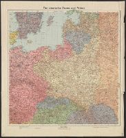
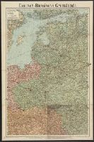
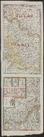
Mounted on linen. Front, back covers affixed to verso., Relief shown by hachures and spot heights; depths shown by isolines., and Shows borders, topographic features, cities and towns, and major transportation routes.
Great Britain. War Office. General Staff. Geographical Section
Published / Created:
1918
Call Number:
36ed 1918
Container / Volume:
BRBL_00127
Image Count:
2
Resource Type:
Maps, Atlases & Globes
Alternative Title:
GSGS (Series) ; 3703a. and GSGS ; 3703a
Description:
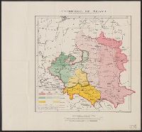
Germany -- Poland -- Northern Italy -- South east Europe., Imperfect: sheets northern Italy and southeast Europe wanting. Ms. annotations on map., and Insets: Density of population.
Publisher:
War Office,
Subject (Geographic):
Balkan Peninsula--Maps, Germany--Maps, Italy, Northern--Maps, and Poland--Maps
Western battle front no. 1, Nieuport to Reims and Western battle front, Reims, France to Basel, Switzerland
Description:
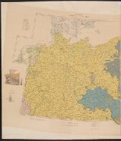
Includes 3 insets: Russo-German war front -- [Franco-German border] -- Pozieres and environs., Includes advertisement for First and old Detroit national bank., Includes ill. of military figures, places, soldiers, etc. with captions., and Shows boundaries, roads,
Publisher:
Geographical Publishing Co.,
Subject (Geographic):
Europe--Maps, France--Maps, Germany--Maps, Poland--Maps, and Russia--Maps
Subject (Topic):
World War, 1914-1918--Europe--Maps, World War, 1914-1918--France--Maps, World War, 1914-1918--Germany--Maps, World War, 1914-1918--Poland--Maps, and World War, 1914-1918--Russia--Maps