Skip to search
Skip to main content
Skip to first result
Search
You Searched For
Subject (Geographic)
Puerto Rico--Maps
Search Results
Creator:
Published / Created:
1898
Call Number:
856 1898
Container / Volume:
BRBL_00643
Image Count:
1
Resource Type:
Maps, Atlases & Globes
Alternative Title:
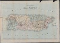
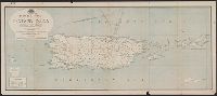
Latest map of island of Puerto Rico, new territory U.S.A.
Description:
Relief shown by hachures.
Publisher:
Colton, Ohman & Co.,
Subject (Geographic):
Puerto Rico--Maps
Found in:
Beinecke Rare Book and Manuscript Library > Latest map of island of Porto[sic] Rico, new territory U.S.A. / by J. M. Lago.
Creator:
Published / Created:
[1898]
Call Number:
855hc 1898A
Container / Volume:
BRBL_00765
Image Count:
1
Resource Type:
Maps, Atlases & Globes
Alternative Title:
Report of the Major-General commanding the Army
Publisher:
Norris Peters Co. Photo-litho,
Subject (Geographic):
Puerto Rico--Maps
Subject (Name):
Norris Peters Co and Ourand, Chas. H
Subject (Topic):
Spanish-American War, 1898--Campaigns--Puerto Rico--Maps
Found in:
Beinecke Rare Book and Manuscript Library > Map of Puerto Rico showing line of march of General Schwan's expedition from Ponce and Yauco to crossing of Rio Prieto August 9-15, 1898 / Chas. H. Ourand.
Published / Created:
1886
Call Number:
856 1886
Container / Volume:
BRBL_00643
Image Count:
1
Resource Type:
Maps, Atlases & Globes
Alternative Title:
Colton's mapa topográfico de la isla de Puerto Rico
Description:
Cover title: Colton's mapa topográfico de la isla de Puerto Rico.
Publisher:
G.W. & C.B. Colton,
Subject (Geographic):
Puerto Rico--Geography and Puerto Rico--Maps
Subject (Name):
G.W. & C.B. Colton & Co
Subject (Topic):
Geography--Puerto Rico
Found in:
Beinecke Rare Book and Manuscript Library > Mapa topográfico de la isla de Puerto Rico.
Creator:
Published / Created:
1898
Call Number:
856 1898B
Container / Volume:
BRBL_00643
Image Count:
1
Resource Type:
Maps, Atlases & Globes
Description:
In upper left corner: Adjutant General's Office, Military Information Division.
Publisher:
Julius Bien,
Subject (Geographic):
Puerto Rico--Maps
Subject (Name):
Bien, Julius, 1826-1909 and United States. Adjutant-General's Office. Military Information Division
Found in:
Beinecke Rare Book and Manuscript Library > Military map, island of Puerto Rico, 1898 / drawn by W. Morey Jr. C.E.
Creator:
Published / Created:
[1898]
Call Number:
855hc 1898J
Container / Volume:
BRBL_00765
Image Count:
1
Resource Type:
Maps, Atlases & Globes
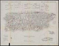
Abstract:
Shows positions of troops in Puerto Rico in 1898.
Alternative Title:
Report of the Major General Commanding for 1898 and Report of the Major-General commanding the Army
Description:
"Enclosure E to accompany report of Nov. 3, 1898, W.M. Black, Lt. Col. Chief Eng. U.V."
Publisher:
Norris Peters Co.,
Subject (Geographic):
Puerto Rico--Maps
Subject (Name):
Morey, W and Norris Peters Co
Subject (Topic):
Spanish-American War, 1898--Campaigns--Puerto Rico--Maps
Found in:
Beinecke Rare Book and Manuscript Library > Military map, island of Puerto Rico, 1898 / drawn by W. Morey Jr. C.E.
Published / Created:
1899
Call Number:
856cea 1899B
Container / Volume:
BRBL_00643
Image Count:
1
Resource Type:
Maps, Atlases & Globes
Description:
"Adapted from chart No.910 U.S. Coast & Geodetic Survey, Washington, D.C., Additions by U.S Fish Commission 1899" below bottom margin.
Publisher:
s.n.,
Subject (Geographic):
Puerto Rico--Maps
Found in:
Beinecke Rare Book and Manuscript Library > Porto Rico
Creator:
Published / Created:
1822]
Call Number:
856 1849
Container / Volume:
BRBL_00696
Image Count:
1
Resource Type:
Maps, Atlases & Globes
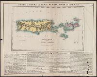
Alternative Title:
Geographical, statistical and historical map of Porto Rico and the Virgin Islands
Description:
Cross Collection no. 291.
Publisher:
H.C. Carey & I. Lea,
Subject (Geographic):
Puerto Rico--Maps and Virgin Islands--Maps
Subject (Name):
Carey & Lea, Carey, Henry Charles, 1793-1879. A complete historical, chronological, and geographical American atlas, Kneass, William, 1780-1840, and Lucas, Fielding, 1781-1854
Found in:
Beinecke Rare Book and Manuscript Library > Porto Rico and Virgin Islands / [cartographic material] / drawn by F. Lucas ; Kneass sc.
Creator:
Published / Created:
1910
Call Number:
856gmd 1910
Container / Volume:
BRBL_00643
Image Count:
1
Resource Type:
Maps, Atlases & Globes
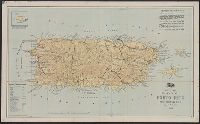
Description:
Includes "List of districts in Porto Rico showing the relative position of each District on the Island."
Publisher:
U.S. Post Office Dept.,
Subject (Geographic):
Puerto Rico--Maps
Subject (Topic):
Postal service--Puerto Rico--Maps
Found in:
Beinecke Rare Book and Manuscript Library > Post route map of Porto Rico : showing post offices with the intermediate distances on mail routes in operation on the 1st of December 1910 / published by order of Postmaster General Frank H. Hitchcock.
Creator:
Published / Created:
1912
Call Number:
856gmd 1912
Container / Volume:
BRBL_00643
Image Count:
1
Resource Type:
Maps, Atlases & Globes
Description:
Includes "List of districts in Porto Rico showing the relative position of each District on the Island."
Publisher:
U.S. Post Office Dept.,
Subject (Geographic):
Puerto Rico--Maps
Subject (Topic):
Postal service--Puerto Rico--Maps
Found in:
Beinecke Rare Book and Manuscript Library > Post route map of Porto Rico : showing post offices with the intermediate distances on mail routes in operation on the 1st of December 1912 / published by order of Postmaster General Frank H. Hitchcock.
Published / Created:
1898
Call Number:
855 1898P
Container / Volume:
BRBL_00641
Image Count:
1
Resource Type:
Maps, Atlases & Globes
Alternative Title:
Evening Post Pub. Co.
Description:
"The Spanish hold all seaports and principal towns. East of Jucaro-Moron Trocha the insurgents are practically in control : the territory to the west is disputed."
Publisher:
Evening Post Pub. Co.,
Subject (Geographic):
Cuba--Maps and Puerto Rico--Maps
Subject (Topic):
Spanish--American War, 1898--Maps
Found in:
Beinecke Rare Book and Manuscript Library > The Evening Post map of Cuba / the Evening Post Pub. Co.