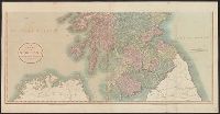
Search
You Searched For
Search Results
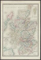
- Published / Created:
- 1811
- Call Number:
- 326 1811
- Container / Volume:
- BRBL_00070
- Image Count:
- 2
- Resource Type:
- Maps, Atlases & Globes
- Description:
- Preliminary record.
- Publisher:
- J. Cary,
- Subject (Geographic):
- Scotland--Maps
- Found in:
- Beinecke Rare Book and Manuscript Library > A new map of Scotland ... by John Cary, Engraver.
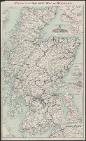
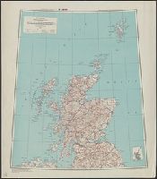
- Creator:
- John Bartholomew and Son
- Published / Created:
- [c1910]
- Call Number:
- 326gme 1910
- Container / Volume:
- BRBL_00071
- Image Count:
- 2
- Resource Type:
- Maps, Atlases & Globes
- Description:
- Includes 3 insets Tour to Trossachs--Loch Katrine & Loch Lomond-- and ill. of station hotels at Glasgow, Perth and Edinburgh.
- Publisher:
- John Bartholomew,
- Subject (Geographic):
- Scotland--Maps
- Subject (Name):
- Caledonian Railway Company and Edinburgh Geographical Institute
- Subject (Topic):
- Railroads--Scotland--Maps
- Found in:
- Beinecke Rare Book and Manuscript Library > Caledonian Railway map of Scotland / John Bartholomew & Co. ; Edinburgh Geographical Institute.
- Creator:
- John Bartholomew and Son
- Published / Created:
- [c1905]
- Call Number:
- 326gme 1905
- Container / Volume:
- BRBL_00071
- Image Count:
- 2
- Resource Type:
- Maps, Atlases & Globes
- Description:
- Includes 3 insets: Tour to Trossachs--Loch Katrine & Loch Lomond-- and ill. of station hotels at Glasgow, Perth and Edinburgh.
- Publisher:
- John Bartholomew,
- Subject (Geographic):
- Scotland--Maps
- Subject (Name):
- Caledonian Railway Company and Edinburgh Geographical Institute
- Subject (Topic):
- Railroads--Scotland--Maps
- Found in:
- Beinecke Rare Book and Manuscript Library > Caledonian Railway map of Scotland / John Bartholomew & Co. ; Edinburgh Geographical Institute.
- Published / Created:
- [1845?]
- Call Number:
- 326 1845
- Container / Volume:
- BRBL_00070
- Image Count:
- 1
- Resource Type:
- Maps, Atlases & Globes
- Description:
- Platt's Grosser Atlas der Erde No. 42a.
- Publisher:
- Rubachschen,
- Subject (Geographic):
- Scotland--Maps
- Found in:
- Beinecke Rare Book and Manuscript Library > Karte v. Schottland. Lith Albr. Platt.
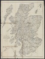
- Published / Created:
- [1890]
- Call Number:
- 3191gm 1890
- Container / Volume:
- BRBL_00041
- Image Count:
- 1
- Resource Type:
- Maps, Atlases & Globes
- Description:
- Inset: Northern Scotland 1:2,000,000.
- Publisher:
- James Wyld,
- Subject (Geographic):
- Great Britain--Maps, Scotland--Maps, and Wales--Maps
- Found in:
- Beinecke Rare Book and Manuscript Library > Road & Railway map of England, Wales and Scotland.
- Published / Created:
- [1890?]
- Call Number:
- 326 1890
- Container / Volume:
- BRBL_00070
- Image Count:
- 1
- Resource Type:
- Maps, Atlases & Globes
- Description:
- Preliminary record.
- Publisher:
- James Wyld,
- Subject (Geographic):
- Scotland--Maps
- Found in:
- Beinecke Rare Book and Manuscript Library > Scotland with its Islands ... by James Wyld.
- Creator:
- United States. Army Map Service
- Published / Created:
- 1943
- Call Number:
- 326gm 1945
- Container / Volume:
- BRBL_00071
- Image Count:
- 1
- Resource Type:
- Maps, Atlases & Globes
- Alternative Title:
- A.M.S. ; 6201 and Series (Standard map series designation system) ; 6201.
- Description:
- Relief shown by hachures and spot heights.
- Publisher:
- U.S. Army Map Service,
- Subject (Geographic):
- Scotland--Maps
- Found in:
- Beinecke Rare Book and Manuscript Library > Scotland: special strategic map [map] / prepared under the direction of the Chief of Engineers, U.S. Army, Washington, D.C.
- Creator:
- John Bartholomew and Son
- Published / Created:
- [c1920]
- Call Number:
- 326cbf 1920A
- Container / Volume:
- BRBL_00070
- Image Count:
- 2
- Resource Type:
- Maps, Atlases & Globes
- Alternative Title:
- Touring map of Scotland
- Description:
- Relief shown by contours, gradient tints, and spot heights.
- Publisher:
- Printed and published by John Bartholomew & Son,
- Subject (Geographic):
- Scotland--Maps
- Subject (Name):
- Automobile Association (Great Britain) and Edinburgh Geographical Institute
- Subject (Topic):
- Roads--Scotland--Maps
- Found in:
- Beinecke Rare Book and Manuscript Library > The Automobile Association Touring map of Scotland / engraved and published by John Bartholomew & Son, Ltd.
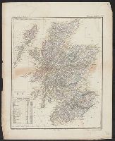
- Published / Created:
- [1885?]
- Call Number:
- 326 1885
- Container / Volume:
- BRBL_00070
- Image Count:
- 1
- Resource Type:
- Maps, Atlases & Globes
- Description:
- Preliminary record.
- Publisher:
- A. & C. Black,
- Subject (Geographic):
- Scotland--Maps
- Found in:
- Beinecke Rare Book and Manuscript Library > The Tourist's map of Scotland. Constructed and engraved by J. Bartholomew.
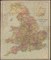
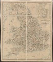
- Published / Created:
- [1855?]
- Call Number:
- 3191gm 1855
- Container / Volume:
- BRBL_00041
- Image Count:
- 1
- Resource Type:
- Maps, Atlases & Globes
- Publisher:
- James Wyld,
- Subject (Geographic):
- Great Britain--Maps, Scotland--Maps, and Wales--Maps
- Found in:
- Beinecke Rare Book and Manuscript Library > Wyld's A map of England, Wales, & Scotland describing all the direct and principal cross roads of Great Britain, with the distances measured between the market towns and from London: Likewise the Great Rivers and Navigable Canals and Railroads.