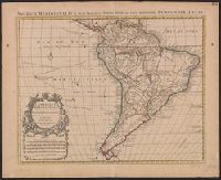
America Meridionalis in suas praecipuas partes divisa ad usum Serenissimi Burgundiae Ducis
Description:
"Avec privilege"., Appears in Cóvens and Mortier's Atlas nouveau; cf. Koeman, C. Atlantes, Cross Collection no. 329., Includes five bar scales., Ms. no. in upper right corner: 101., Prime meridian: Ferro., and Relief shown pictorially.
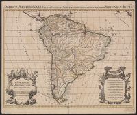
America meridionalis in suas praecipuas partes accurate divisa, ad usum serenissimi Burgundiae Ducis
Description:
Appears in Jaillot's Atlas françois., Cross Collection no. 324., Includes eight bar scales., Ms. no. in upper right corner: 14., Plate copied from Nicolas Sanson., Prime meridian: Ferro., and Watermark.
Publisher:
[Alexis Hubert Jaillot],
Subject (Geographic):
South America--Maps--Early works to 1800
Subject (Name):
Jaillot, Alexis Hubert, 1632?-1712. Atlas françois and Sanson, Nicolas, 1600-1667
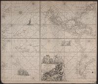
"Met Priviligie voor 15 Iaar.", From Keulen's Groote nieuwe vermeerderde zee-atlas ofte water-waereld / Johannes van Keulen., Map, State 1. Imperfect: small hole in lower right corner, with no loss of text. Cross Collection 69., and Title in cartouche.
Publisher:
By Ioannes van Keulen, aen de Nieuwe brugh in de Gekroonde Lootsman,
Subject (Geographic):
North America--Maps--Early works to 1800, Pacific Area--Maps--Early works to 1800, and South America--Maps--Early works to 1800
Subject (Name):
Keulen, Johannes van, 1654-1715. Groote nieuwe vermeerderde zee-atlas ofte water-waereld
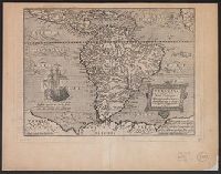
Cross Collection no. 318., From Quad's Geographisch Handtbuch. Coln am Rein : Bey Iohan Buxemacher ..., 1600., In Latin on verso; with caption title "Peruvia" and paginated 84., Mounted on linen., and Relief shown pictorially.
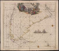
Nieuwe perfecte pascaert van t' Suyderlyckste deel van Suyt America van Rio de la Plata door de straet Magellaen tot Toral
Description:
Appears in Wit's Orbis Maritimus ofte Zee Atlas., Bar scales in "Geometrische of Duytsche Mylen ...," and "France Mylen ... miliaria Gallica.", Cross Collection no. 333., and Title in ms. on verso, with ms. no. 160.
Publisher:
Frederick de Wit,
Subject (Geographic):
Magellan, Strait of (Chile and Argentina)--Maps--Early works to 1800 and South America--Maps--Early works to 1800
Subject (Name):
Wit, Frederik de. Orbis Maritimus ofte Zee Atlas
Subject (Topic):
Coasts--South America--Maps--Early works to 1800 and Nautical charts--Magellan, Strait of (Chile and Argentina)--Maps--Early works to 1800
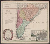
A note on the margin of the map in Latin text gives some historical data and comments upon the climate as being very cold and that the name (Chili) is therefore significan, In Latin and French., Inset: Plan de la ville de Santiago., and Relief shown pictorially.
Publisher:
Editoribus Homannianis Heredibus,
Subject (Geographic):
Santiago (Chile)--Maps--Early works to 1800 and South America--Maps--Early works to 1800
Subject (Name):
Homann Erben (Firm). Atlas geographicus maior and Techo, Nicolás del, 1611-1685