Search
You Searched For
Search Results
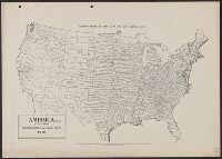
- Creator:
- Goode, J. Paul, 1862-1932
- Published / Created:
- c1910.
- Call Number:
- 75fb 1910A
- Container / Volume:
- BRBL_00410
- Image Count:
- 1
- Resource Type:
- Maps, Atlases & Globes
- Alternative Title:
- Goode's series of base maps ; no. 32B
- Description:
- Shows county boundaries.
- Publisher:
- University of Chicago Press,
- Subject (Geographic):
- United States--Administrative and political divisions--Maps and United States--Maps
- Found in:
- Beinecke Rare Book and Manuscript Library > America (U.S.) by counties.
- Creator:
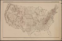
- United States. Office of Farm Management
- Published / Created:
- 1915
- Call Number:
- 75gce 1915
- Container / Volume:
- BRBL_00410
- Image Count:
- 1
- Resource Type:
- Maps, Atlases & Globes
- Alternative Title:
- Outline map of the United States by counties
- Description:
- "Jan. 1, 1915" in lower left margin.
- Publisher:
- Office of Farm Management,
- Subject (Geographic):
- United States--Administrative and political divisions--Maps and United States--Maps
- Subject (Name):
- Geological Survey (U.S.)
- Subject (Topic):
- Irrigation--United States--Maps
- Found in:
- Beinecke Rare Book and Manuscript Library > Irrigation map of the United States / engraved and printed by the U.S. Geological Survey ; outline of irrigated areas based upon data collected by the Bureau of the Census, 1910 ; revised by Irrigation Division, Office of Experimental Stations, and by the
- Creator:
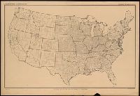
- United States. Department of Agriculture. Division of Publications
- Published / Created:
- 1910
- Call Number:
- 75fb 1910
- Container / Volume:
- BRBL_00410
- Image Count:
- 1
- Resource Type:
- Maps, Atlases & Globes
- Description:
- "April 15, 1910."
- Publisher:
- The Division,
- Subject (Geographic):
- United States--Administrative and political divisions--Maps and United States--Maps
- Subject (Name):
- Geological Survey (U.S.)
- Found in:
- Beinecke Rare Book and Manuscript Library > Outline map of the United States by counties / engraved and printed by the U.S. Geological Survey.
- Creator:
- United States. Department of Agriculture. Division of Publications
- Published / Created:
- 1915
- Call Number:
- 75eb 1910B
- Container / Volume:
- BRBL_00410
- Image Count:
- 1
- Resource Type:
- Maps, Atlases & Globes
- Description:
- "Jan. 1, 1915."
- Publisher:
- The Division,
- Subject (Geographic):
- United States--Administrative and political divisions--Maps and United States--Maps
- Subject (Name):
- Geological Survey (U.S.)
- Found in:
- Beinecke Rare Book and Manuscript Library > Outline map of the United States by counties / engraved and printed by the U.S. Geological Survey.