Skip to search
Skip to main content
Skip to first result
Search
You Searched For
Subject (Geographic)
United States--Boundaries--Canada--Maps
New Search
Search Results
Creator:
Published / Created:
1952]
Call Number:
848fab 1951
Container / Volume:
BRBL_00635
Image Count:
15
Resource Type:
Maps, Atlases & Globes
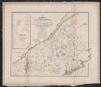
Description:
"To accompany the Commissioner's joint report dated November 26, 1951. Upon the establishment of the boundary from Tongass Passage to Mount St. Elias in accordance with the convention of January 24, 1903, the award of the tribunal, appointed under the convention signed at London October 20, 1903 ..."
Publisher:
U.S. G.P.O.,
Subject (Geographic):
Alaska--Boundaries--Canada--Maps, Canada--Boundaries--United States--Maps, and United States--Boundaries--Canada--Maps
Found in:
Beinecke Rare Book and Manuscript Library > Joint maps of the international boundary between United States and Canada from Cape Muzon to Mount St. Elias.
Creator:
Published / Created:
1843
Call Number:
73fab 1843
Container / Volume:
BRBL_00375B
Image Count:
1
Resource Type:
Maps, Atlases & Globes
Alternative Title:
Rouse's Point and its vicinity on Lake Champlain.
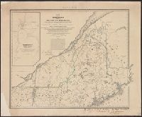
Description:
Backed with linen. and Includes text and map of "Rouse's Point and its vicinity on Lake Champlain."
Publisher:
Corps of Topl. Engineers,
Subject (Geographic):
Canada--Boundaries--United States--Maps and United States--Boundaries--Canada--Maps
Subject (Name):
Graham, J. D. (James Duncan), 1799-1865 and Graham, J. D.--(James Duncan),--1799-1865--Presentation inscription to Yale College
Found in:
Beinecke Rare Book and Manuscript Library > Map of the boundary lines between the United States and the adjacent British provinces : from the mouth of the River St. Croix to the intersection of the parallel of 45 degrees of north latitude with the River St. Lawrence near St. Regis.
Creator:
Published / Created:
1843
Call Number:
73fab 1843
Container / Volume:
BRBL_00375B
Image Count:
1
Resource Type:
Maps, Atlases & Globes
Alternative Title:
Rouse's Point and its vicinity on Lake Champlain.
Description:
"Map G no. 3." and Includes text and map of "Rouse's Point and its vicinity on Lake Champlain."
Publisher:
Corps of Topl. Engineers,
Subject (Geographic):
Canada--Boundaries--United States--Maps and United States--Boundaries--Canada--Maps
Found in:
Beinecke Rare Book and Manuscript Library > Map of the boundary lines between the United States and the adjacent British provinces : from the mouth of the River St. Croix to the intersection of the parallel of 45 degrees of north latitude with the River St. Lawrence near St. Regis.
Creator:
Published / Created:
1883?]
Call Number:
847 1883
Container / Volume:
BRBL_00625
Image Count:
1
Resource Type:
Maps, Atlases & Globes
Description:
Blueprint., Includes list of authorities., and Shows portions of Washington Territory and British Columbia.
Publisher:
s.n.,
Subject (Geographic):
Canada--Boundaries--United States--Maps, United States--Boundaries--Canada--Maps, and Washington (State)--Maps
Subject (Name):
Poe, O. M. (Orlando Metcalfe), 1832-1895
Found in:
Beinecke Rare Book and Manuscript Library > Map of the n.w. boundaries of the United States / compiled in 1883 under the direction of Bvt. Brig. Gen'l. O.M. Poe, U.S. Army Lt. Col. of Engineers, Col. & A.D.C. ; compiled & drawn by J. von Glümer.
Branch:v1.64.0 ,Deployed:2024-09-11T10:25:35-04:00