Search
You Searched For
Search Results
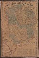
- Creator:
- Wells, E
- Published / Created:
- 1861
- Call Number:
- 754hc 1861
- Container / Volume:
- BRBL_00420
- Image Count:
- 2
- Resource Type:
- Maps, Atlases & Globes
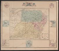
- Description:
- Ancillary maps of New Orleans, Baltimore, St. Louis, Charleston, Savannah, Washington City, Mobile.
- Publisher:
- D. Appleton & Co.,
- Subject (Geographic):
- Middle Atlantic States--History--Civil War, 1861-1865--Maps and United States--History--Civil War, 1861-1865--Maps
- Subject (Name):
- D. Appleton and Company
- Found in:
- Beinecke Rare Book and Manuscript Library > Appletons' map of the seat of war no. 1 / drawn by E. Wells.
- Published / Created:
- [1864?]
- Call Number:
- 754hc 1864A
- Container / Volume:
- BRBL_00421
- Image Count:
- 1
- Resource Type:
- Maps, Atlases & Globes
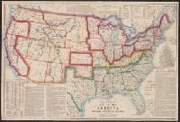
- Description:
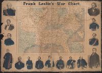
- "Drawn on wood by G. W. Colton."
- Publisher:
- Frank Leslie,
- Subject (Geographic):
- United States--History--Civil War, 1861-1865--Maps and United States--History--Civil War, 1861-1865--Pictorial works
- Subject (Name):
- Colton, G. Woolworth (George Woolworth), 1827-1901 and Leslie, Frank, 1821-1880
- Found in:
- Beinecke Rare Book and Manuscript Library > Frank Leslie's war chart : map of the southern and border states, showing the actual positions of the National and Rebel forces, and of the blockading fleets and vessels, the positions of the various fortifications that have been erected, and the localiti
- Creator:
- Leslie, Frank, 1821-1880
- Published / Created:
- [1862]
- Call Number:
- 754hc 1862A
- Container / Volume:
- BRBL_00421
- Image Count:
- 2
- Resource Type:
- Maps, Atlases & Globes
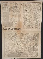
- Alternative Title:
- Frank Leslies illustrated newspaper. and War maps and companion to the newspaper
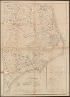
- Description:
- Map of Savannah, Georgia and its surroundings
- Publisher:
- Frank Leslie,
- Subject (Geographic):
- United States--History--Civil War, 1861-1865--Maps and United States--History--Civil War, 1861-1865--Newspapers
- Subject (Name):
- Colton, G. Woolworth (George Woolworth), 1827-1901
- Found in:
- Beinecke Rare Book and Manuscript Library > Frank Leslie's war maps and companion to the newspaper.
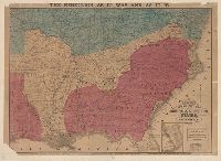
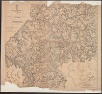
- Creator:
- United States. Army. Corps of Engineers
- Published / Created:
- 1875
- Call Number:
- 787 At62 1875
- Container / Volume:
- BRBL_00517
- Image Count:
- 1
- Resource Type:
- Maps, Atlases & Globes
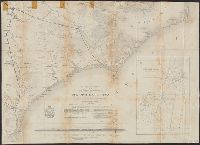
- Description:
- "Surveys made by J.T. Dodge and H.H. Ruger Civil Eng'rs. Map of the Atlanta Campaign compiled under the direction of Capt. O.M. Poe, U.S. Eng'rs."
- Publisher:
- Corps of Engineers?],
- Subject (Geographic):
- United States--History--Civil War, 1861-1865--Maps
- Subject (Name):
- Poe, O. M. (Orlando Metcalfe), 1832-1895 and Sherman, William T. (William Tecumseh), 1820-1891
- Subject (Topic):
- Atlanta Campaign, 1864--Maps
- Found in:
- Beinecke Rare Book and Manuscript Library > Map illustrating the military operations in front of Atlanta, Ga. : from the passage of Peach Tree Creek, July 19th 1864, to the commencement of the movement upon the enemy's lines of communication, South of Atlanta, August 26th 1864, Maj. Gen'l W.T. Sher