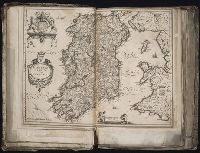
Appears in the author's L'isole piu famose del mondo, descritte da Thomaso Porcacchi da Castiglione Arretino e intagliate da Girolamo Porro Padovano..., p. 70.
General map of Great Britain and Ireland with part of Holland, Flanders France &c. agreable to modern history by the heirs of late Mr. Homann at Nuremburg, priviledged by Emperours Majesty
Description:
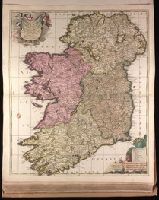
BEIN 1975 Folio 31: Imperfect: torn along fold and frayed along edges, with no loss of text. Sheet measures 53 x 60.7 cm. No. 7 of 42 maps bound together.
General map of Great Britain and Ireland with part of Holland, Flanders France &c. agreable to modern history by the heirs of late Mr. Homann at Nuremburg
General map of Great Britain and Ireland with part of Holland Flandres France &c. agreable to modern history by the heirs of late Mr. Homann at Nüremburg 1749, priviledged by Emperours Majesty
Description:
BEIN 1973 Folio 30: Sheet measures 53.9 x 61.8 cm. No. 7 of 32 maps bound together.