Skip to search
Skip to main content
Skip to first result
Search
You Searched For
Subject Heading
Saxony-Anhalt (Germany) > Maps > Early works to 1800
Search Results
Creator:
Published / Created:
ca. 1702?]
Call Number:
1973 Folio 18
Image Count:
1
Description:
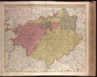
BEIN 1973 Folio 18: Backed with paper. Ms. no. in upper right corner: 24. Sheet measures 53.7 x 62.7 cm. No. 24 of 87 maps bound together.
Publisher:
Gerard Valck
Subject (Geographic):
Brandenburg (Germany), Saxony (Germany), Saxony-Anhalt (Germany), and Thuringia (Germany)
Subject (Topic):
Maps
Found in:
Beinecke Rare Book and Manuscript Library > Circulus Saxoniae superioris, divisa in ducatus Saxoniae, Altenburgi, Vinariae, Gothae, et Isenaci, principatum Anhaltinum, comitatus Suartenburgi, Barbiae, et Bichlingii, episcoptatius Ceitzii et Halae, cum reliquis ditionibus [cartographic material]
Creator:
Published / Created:
[1633]
Call Number:
1983 Folio 19
Image Count:
1
Description:
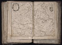
BEIN 1983 Folio 19: Imperfect: holes along folds, with some loss of text; edges reinforced with ms. waste. Sheet measures 38.7 x 49.7 cm. No. 71 of 92 maps bound together.
Publisher:
Henricus Hondius excudit
Subject (Geographic):
Saxony-Anhalt (Germany)
Found in:
Beinecke Rare Book and Manuscript Library > Comitatus Mansfeldia [cartographic material].
Creator:
Published / Created:
[1750]
Call Number:
1973 Folio 30
Image Count:
2
Description:
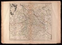
BEIN 1973 Folio 30: Sheet measures 53.7 x 62.1 cm. No. 18 of 32 maps bound together.
Publisher:
Anjezo im Verlag beij Tob. Conr. Lotter, Geogr. in Augsburg
Subject (Geographic):
Saxony-Anhalt (Germany)
Found in:
Beinecke Rare Book and Manuscript Library > Delineatio geographica comitatus Mansfeldensis ad jurisdictionem tum Saxonicam tum Brandenburgicam spectans, cum praefectura Sangerhusana, Querfurtensi, Sittenbacensi, Allstaedensi, et loci finitimis
Creator:
Published / Created:
1783.
Call Number:
1983 Folio 23
Image Count:
1
Alternative Title:
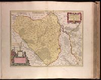
Circuli superioris Saxoniae pars meridionalis, Ducatum, Electoratum & Principatus Ducum Saxoniae, Princip. Anhalt. Comit. Schwarzburg, Mansfeld, Stolberg &cc
Description:
BEIN 1983 Folio 23: Sheet measures 54.4 x 64.1 cm. No. 40 of 50 maps bound together.
Publisher:
Homann Erben
Subject (Geographic):
Brandenburg (Germany), Saxony-Anhalt (Germany), Saxony (Germany), and Thuringia (Germany)
Found in:
Beinecke Rare Book and Manuscript Library > Der südliche Theil des Ober-Saechsischen Kreises : die Chur-und Fürstl Sächsische und andere hiehergehörige Länder vorstellend
Creator:
Published / Created:
[ca. 1758]
Call Number:
1973 Folio 30
Image Count:
2
Description:
BEIN 1973 Folio 30: Sheet measures 53.7 x 62 cm. No. 23 of 32 maps bound together.
Publisher:
Anjezo im Verlag bey Tobias Conrad Lotter, Geogr. ...
Subject (Geographic):
Saxony-Anhalt (Germany)
Found in:
Beinecke Rare Book and Manuscript Library > Episcopatus Numburgensis et cizensis delineatio geographica adjectis praefecturis Portensi, Pegaviensi, Tautenburg et finitimis / [cartographic material]
Creator:
Published / Created:
1743.
Call Number:
1977 Folio 177
Image Count:
2
Description:
BEIN 1977 Folio 177: Stamp on verso: 286. Ms. title on verso. Sheet measures 54.3 x 68.7 cm. No. 31 of 34 maps bound together.
Publisher:
Par et chez le Sr. le Rouge ingenieur geographe du roi rüe des grand.s Augustins vis a vis le panier fleuri
Subject (Geographic):
Germany, Saxony, Saxony (Germany), Saxony-Anhalt (Germany), and Thuringia (Germany)
Subject (Topic):
Post roads
Found in:
Beinecke Rare Book and Manuscript Library > La Saxe contenant les routtes et les postes [cartographic material].
Creator:
Published / Created:
ca. 1670]
Call Number:
1973 Folio 18
Image Count:
1
Description:
BEIN 1973 Folio 18: Backed with paper. Ms. no. in upper right corner: 21. Sheet measures 53.7 x 62.5 cm. No. 21 of 87 maps bound together.
Publisher:
Joan Blaeu
Subject (Geographic):
Saxony-Anhalt (Germany)
Subject (Topic):
Maps
Found in:
Beinecke Rare Book and Manuscript Library > Marchionatus Brandenburgici pars, quae marchia vetus, vulgo Altemarck dicitur [cartographic material].