Skip to search
Skip to main content
Skip to first result
Search
You Searched For
Subject Heading
Turkey > Maps
Search Results
Creator:
Published / Created:
ca. 1702]
Call Number:
1973 Folio 18
Image Count:
1
Description:
BEIN 1973 Folio 18: Backed with paper. Ms. no. "82" in upper left corner. Sheet measures 62.5 x 53.7 cm. No. 76 of 87 maps bound together.
Publisher:
Gerard Valk
Subject (Geographic):
Bulgaria, Romania, and Turkey
Subject (Topic):
Maps
Found in:
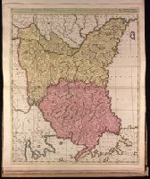
Beinecke Rare Book and Manuscript Library > Bulgaria et Romania divisa in singulares sangiacatus Silistriam, Nicopolin, Bodinum, Sardiam, Bysantium, Kirkeliam et Gallipolin, una cum finitimis regionibus Valachia, Servia etc. / [cartographic material]
Creator:
Published / Created:
1680.
Call Number:
1973 Folio 10
Image Count:
1
Alternative Title:
Europe divided into its principall parts viz. the Brittish [sic] Islands, Scandinavia, Moscovia, France, Germany, Poland, Spain, Italy, Turky [sic] in Europe ... described by Sanson, corrected and amended by William Berry
Description:
BEIN 1973 Folio 10: Sheet measures 61 x 96.3 cm. Bookplate of José M. Rodriguez. No. 2 of 63 maps bound together.
Publisher:
Sold by William Berry at ye sign of the globe between Charing-Cross and White-Hall
Subject (Geographic):
Europe, Russia, and Turkey
Found in:
Beinecke Rare Book and Manuscript Library > Europe divided into its principall states, which are subdivided into their principall provinces
Creator:
Published / Created:
January 1st, 1790.
Call Number:
1982 Folio 10
Image Count:
1
Description:
BEIN 1982 Folio 10: Armorial bookplate: Charles Abbot. No. 27 of 42 maps bound together.
Publisher:
Willm. Faden
Subject (Geographic):
Greece and Turkey
Found in:
Beinecke Rare Book and Manuscript Library > Greece, Archipelago and part of Anadoli
Creator:
Published / Created:
[ca. 1689?]
Call Number:
1973 Folio 10
Image Count:
1
Alternative Title:
Dominions or empire of the great Turke in Europe, Asia, and Africa ... described by Sanson, corrected and amended by Will. Berry
Description:
BEIN 1973 Folio 10: Sheet measures 61 x 95.8 cm. Bookplate of José M. Rodriguez. No. 50 of 63 maps bound together.
Publisher:
Sold by William Berry at the signe of the Globe between Charing Cross, and White Hall
Subject (Geographic):
Mediterranean Region, Arabian Peninsula, Africa, North, and Turkey
Found in:
Beinecke Rare Book and Manuscript Library > The empire of the great Turke [sic] in Europe, Asia, & Africa : divided into all its Beglerbeglicz or governments in which are also distinguished the states that are tributary to him
Creator:
Published / Created:
Jany. 11th, 1786.
Call Number:
1982 Folio 10
Image Count:
1
Description:
British Art Center copy has no case.
Publisher:
Willm. Faden ...
Subject (Geographic):
Turkey and Greece
Subject (Topic):
Maps
Found in:
Beinecke Rare Book and Manuscript Library > The sea of Marmara or Propontis : with the straits of Constantinople and of Gallipoli
Creator:
Published / Created:
1683.
Call Number:
1973 Folio 10
Image Count:
1
Alternative Title:
Dominions of Turky in Europe in which are the governments of Romelia of the sea, of Buda, of Teme's war, and of Bosnia ... described by Sanson, corrected and amended by William Berry
Description:
BEIN 1973 Folio 10: Sheet measures 61.2 x 96.4 cm. Bookplate of José M. Rodriguez. No. 24 of 63 maps bound together.
Publisher:
Sold by William Berry at the signe of the Globe between Charing-Cross and White-Hall
Subject (Geographic):
Turkey, Italy, and Balkan Peninsula
Found in:
Beinecke Rare Book and Manuscript Library > The states of the empire of the Turks in Europe : subdivided according to ye extent of its governments
Creator:
Published / Created:
1635?]
Call Number:
1983 Folio 19
Image Count:
2
Alternative Title:
Tvrcicvm imperivm and Imperium Turcicum in Europa, Asia et Africa regiones proprias, tributar, et clientelares exhibens
Description:
BEIN 1983 Folio 19: Imperfect: torn and mutilated along fold and edges, partially repaired, with some loss of text; cartouche cut-out and replicated in ms. with new title "Imperium Turcicum in Europa, Asia et Africa regiones proprias, tributar, et cli...
Publisher:
Joan Blaeu
Subject (Geographic):
Turkey
Subject (Topic):
Geography
Found in:
Beinecke Rare Book and Manuscript Library > Turcicum imperium
Creator:
Published / Created:
ca. 1702?]
Call Number:
1973 Folio 18
Image Count:
1
Alternative Title:
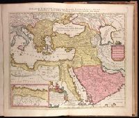
Imperium Turcicum, complectens Europae, Asiae et Africae, Arabiae que regiones ac provincias plurimas, industria et labore Petr. Schenck
Description:
BEIN 1973 Folio 18: Backed with paper. Ms. no. "91" in upper right-hand corner. Sheet measures 53.6 x 62.5 cm. No. 83 of 87 maps bound together.
Publisher:
P. Schenck, avec privil
Subject (Geographic):
Middle East, Turkey, Europe, Southern, and Africa, North
Subject (Topic):
Maps
Found in:
Beinecke Rare Book and Manuscript Library > [Est]ats de L'Empire du Grand Seigneur des Turcs Europe, en Asie, et en Afrique divise en tous ses Beglerbeglicz ou Gouvernements ou sont aussi remarques les Estats qui luy sont Tributaires dresse sur les plus nouvelles relations / [cartographic material]