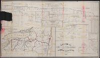
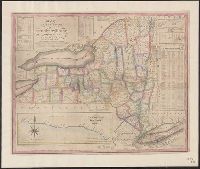
"In examining these profiles be governed by figures, not by scale. The scales, horizontal and vertical, being too small to place the locks in accurate position in several places.", Ms. markings. Imperfec, and Relief shown by contours and hachures.
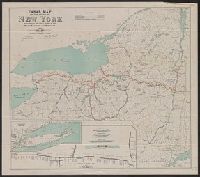
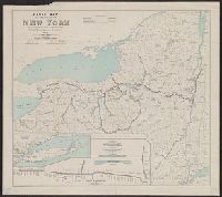
Also shows drainage, canals and county boundaries., Imperfect: mutilated with some loss of text., and Includes table detailing "Length of rail roads in operation."
Publisher:
Lith. by Weed, Parsons & Co.,
Subject (Geographic):
New York (State)--Administrative and political divisions--Maps and New York (State)--Maps
Subject (Name):
Seymour, Horatio, 1810-1886 and Smalley, Edward D
Subject (Topic):
Canals--New York (State)--Maps and Railroads--New York (State)--Maps
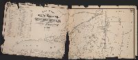
Profile of the northern canal and Profile of the western canal, H. Phelps, New York, 1832
Description:
Below title is lo, Folded into red publisher's boards stamped: New York., Inset tables provide information on distances and routes, colleges in the state, population, and newspapers published in state., and Insets show profiles of Erie Canal and Champlain Canal.
Publisher:
Humphrey Phelps,
Subject (Geographic):
Champlain Canal (N.Y.)--Maps, Erie Canal (N.Y.)--Maps, and New York (State)--Maps