
You Searched For
« Previous
| 1 - 10 of 45 |
Next »
Search Results
2.

- Creator:
- Hennepin, Louis, 17th cent
- Published / Created:
- 1698 (8vo)
- Call Number:
- Zc20 697heg
- Image Count:
- 7
- Alternative Title:
- Nouvelle découverte d'un très grand pays situé dans l'Amérique entre le Nouveau Mexique et la mer Glaciale. English and New discovery of a large country in America by Father Lewis Hennepin
- Description:
- BEIN Vanderbilt 75: Imperfect: Map for part II wanting. Unidentified armorial bookplate. Autograph: Lib. [Giwn]? Lloyd. Booklabel: W.S. Hiltz.
- Publisher:
- Printed for M. Bentley, J. Tonson, H. Bonwick, T. Goodwin, and S. Manship
- Subject (Geographic):
- Mississippi River Valley, Great Lakes (North America), Canada, and Niagara Falls (N.Y. and Ont.)
- Subject (Name):
- La Salle, Robert Cavelier, sieur de, 1643-1687.
- Subject (Topic):
- Indians of North America, Discovery and exploration, History, and Description and travel
- Found in:
- Beinecke Rare Book and Manuscript Library > A new discovery of a vast country in America : extending above four thousand miles, between New France and New Mexico : with a description of the great lakes, cataracts, rivers, plants, and animals : also, the manners, customs, and languages of the several native Indians, and the advantage of commerce with those different nations : with a continuation, giving an account of the attempts of the Sieur de la Salle upon the mines of St. Barbe, &c. : the taking of Quebec by the English, with the advantages of a shorter cut to China and Japan : both parts illustrated, with maps and figures, and dedicated to His Majesty K. William
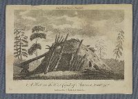
3.
- Creator:
- Woodcock, Joseph, active 1786. artist
- Published / Created:
- June 17, 1789.
- Call Number:
- BrSides Zc86 789wo
- Image Count:
- 1
- Resource Type:
- still image and text
- Abstract:
- View of sailing ship and canoes in Coal Harbour, near Port Graham, Alaska, on the southern end of Kenai Peninsula
- Description:
- Title from caption below image.
- Publisher:
- Publish'd by J. Stockdale & G. Goulding
- Subject (Geographic):
- Kenai Peninsula (Alaska) and Northwest Coast of North America
- Subject (Topic):
- Discovery and exploration and British
- Found in:
- Beinecke Rare Book and Manuscript Library > A view in Coal Harbour in Cook's River
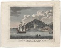
4.

- Published / Created:
- May 1, 1789.
- Call Number:
- BrSide4o Zc70 789vi
- Image Count:
- 1
- Resource Type:
- still image and text
- Abstract:
- Print shows a view of a settlement at Goulding's Harbor, a side channel of Portlock's Harbor between Sitka and Juneau in Alaska, visited by the ships King George and Queen Charlotte and Captains Portlock and Dixon. Two men holding rope, pulling small ...
- Description:
- BEIN BrSide4o Zc70 789vi: On sheet 18.3 x 23,0 cm.
- Publisher:
- Publish'd by J. Stockdale & G. Goulding
- Subject (Geographic):
- Northwest Coast of North America and Alaska
- Subject (Topic):
- Indians of North America, Voyages around the world, and Discovery and exploration
- Found in:
- Beinecke Rare Book and Manuscript Library > A view in Goulding's Harbour, North West coast of America
5.
- Creator:
- James, Edwin, 1797-1861, compiler
- Published / Created:
- 1822-1823.
- Call Number:
- Zc20 +822ja
- Image Count:
- 41
- Resource Type:
- text and still image
- Alternative Title:
- Major Long's Expedition to the Rocky Mountains and Expedition to the Rocky Mountains
- Description:
- Spine title, on publisher's printed labels: Major Long's Expedition to the Rocky Mountains.
- Publisher:
- H.C. Carey and I. Lea, Chesnut St.
- Subject (Geographic):
- West (U.S.), Ohio River, Missouri River, and United States
- Subject (Topic):
- Discovery and exploration, Indians of North America, Languages, Geology, Discoveries in geography, and Glossaries, vocabularies, etc
- Found in:
- Beinecke Rare Book and Manuscript Library > Account of an expedition from Pittsburgh to the Rocky Mountains : performed in the years 1819 and '20, by order of the Hon. J.C. Calhoun, Sec'y of War ; under the command of Major Stephen H. Long : from the notes of Major Long, Mr. T. Say, and other gentlemen of the exploring party
6.
- Creator:
- Malaspina, Alessandro, 1754-1809
- Call Number:
- WA MSS S-662
- Image Count:
- 645
- Abstract:
- Papers pertaining to the 1789 Spanish exploration of the Northwest Coast of North America. Under the command of Alessandro Malaspina, the expedition sailed from Cadiz to the west coast of Africa, across the Atlantic to South America, south to the Falk...
- Description:
- Available on microfilm.
- Subject (Geographic):
- Northwest Coast of North America and Northwest Passage.
- Subject (Name):
- Cordova, Luis de., Eguia, Manuel de., Fernán-Núñez, Carlos José Gutiérrez de los Ríos y Rohan Chabot, conde de, 1742-1795., Gutierrez de Rubalcava, Joaquin., Malaspina, Alessandro, 1754-1809., Mazarredo, Joseph., Muñoz, Xavier, fl. 1786., Revillagigedo, Juan Vicente Güémez Pacheco de Padilla Horcasitas y Aguayo, conde de, 1740-1799., Sesma, Fermin., Sevena, Pedro de., Valdés y Bazan, Antonio, 1744-1816., Atrevida (Corvette), and Descubierta (Corvette)
- Subject (Topic):
- Voyages around the world, Discovery and exploration, and Spanish
- Found in:
- Beinecke Rare Book and Manuscript Library > Alessandro Malaspina papers, 1788-1809
7.
- Published / Created:
- anno MDLXXXXIIII [1594]
- Call Number:
- Taylor 192 4-6
- Image Count:
- 4
- Alternative Title:
- America. pars 4. Latin, Americae pars qvarta, Insignis & admiranda historia, and Insignis et admiranda historia
- Description:
- BEIN Taylor 192 4: Map: Occidentalis Americae partis ... (32 x 43 cm, on sheet 34 x 45 cm, folded to 32 x 19 cm) bound following leaf 2):(4 [i.e. p. [8], first count]. Bookplate of Paul Methuen. No. 1 of 3 titles bound together.
- Publisher:
- Typis Ioannis Feyrabend : Impensis Theodori de Bry
- Subject (Geographic):
- America and Latin America
- Subject (Topic):
- Discovery and exploration, Spanish, History, and Description and travel
- Found in:
- Beinecke Rare Book and Manuscript Library > Americae pars quarta, sive, Insignis & admiranda historia de reperta primùm Occidentali India à Christophoro Columbo anno MCCCCXCII
8.
- Published / Created:
- 1595]
- Call Number:
- Taylor 192 4-6
- Image Count:
- 6
- Alternative Title:
- America. pars 5
- Description:
- BEIN Taylor 192 4-6: Final blank, F4, wanting. Map Hispaniae Nouae (33 x 44 cm, on sheet 34 x 45 cm, folded to 32 x 21 cm) bound after t.p. Divisional title for plates with correction "invictis" on third from last line of title. No. 2 of 3 titles boun...
- Publisher:
- Theodore de Bry
- Subject (Geographic):
- America, Latin America, and Mexico
- Subject (Topic):
- Discovery and exploration, Spanish, History, and Description and travel
- Found in:
- Beinecke Rare Book and Manuscript Library > Americae pars quinta nobilis & admiratione plena Hieronymi Bezoni Mediolanensis secundae sectionis Hia. Hispanorum tùm in Nigrittas seruos suos, tùm in Indos crudelitatem, Gallorumq[ue] pirataru[m] de Hispanis toties reportata spolia aduentu[m] item Hispanoru[m] in Nouam Indiae continentis Hispaniam, eorumq[ue] contra incolas eius regionis saeuitiam explicans : addita ad singula fere capita scholia, in quibus res Indiae luculenter exponuntur : accessit praeterea tabula chorographica Nouae Hispaniae in India Occidentali, ad invistis Rudolph II. Ro. Imp. Aug., omnia figuris in aes incisis expressa à Theodoro de Bry Leod, cive Franc. a[nn]o MDXCV
9.

- Creator:
- Roberts, Henry, 1757-1796, cartographer
- Published / Created:
- July 24, 1784.
- Call Number:
- 1982 Folio 10
- Image Count:
- 1
- Resource Type:
- cartographic image
- Alternative Title:
- Chart of the northwest coast of America and the northeast coast of Asia, explored in the years 1778 and 1779
- Description:
- BEIN 23 1784: Sheet measures 53 x 80.5 cm.
- Publisher:
- Published by Wm. Faden, geographer to the King, Charing Cross
- Subject (Geographic):
- North America, Russian Far East (Russia), Bering Strait Region, and Pacific Coast (North America)
- Subject (Name):
- Cook, James, 1728-1779.
- Subject (Topic):
- Discovery and exploration and Discoveries in geography
- Found in:
- Beinecke Rare Book and Manuscript Library > Chart of the N.W. coast of America and the N.E. coast of Asia, explored in the years 1778 and 1779
10.
- Published / Created:
- ca. 1565.
- Call Number:
- WA MSS S-2533
- Image Count:
- 14
- Abstract:
- Nahuatl map on maguey paper documenting agricultural holdings in the Valley of Mexico, probably fields of bulrush or maize under the colonial jurisdiction of Tenochtitlan-Mexico City, ca. 1565
- Description:
- Available on x-ray film
- Subject (Geographic):
- Mexico, Mexico., Mexico City (Mexico), and Mexico, Valley of (Mexico)
- Subject (Name):
- Alvarado Huanitzin, Don Diego de., Cecepátic, Don Cristóbal de., Guzmán, Don Esteban de., San Francisco Tehuetzquititzin, Don Diego de., Santa María Cipac, Don Luis de., and Velasco, Luis de, 1500?-1564.
- Subject (Topic):
- Agriculture, Corn, Indian cartography, Indians of Mexico, Discovery and exploration, History, Maps, and Early works to 1800
- Found in:
- Beinecke Rare Book and Manuscript Library > Codex Reese