Skip to search
Skip to main content
Skip to first result
Search
You Searched For
Subject (Topic)
Nautical charts
Search Results
Creator:
Published / Created:
1760.
Call Number:
2003 Folio 85
Image Count:
1
Description:
BEIN 2003 Folio 85: No. 44 of 45 maps bound together with binder's spine title: Atlas of America; ms. table of contents. Bookplate: Robinson. Bookplate of Paul Mellon.
Publisher:
Dépost des cartes et plans de la marine
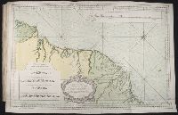
Subject (Geographic):
French Guiana and Cayenne (French Guiana)
Subject (Topic):
Nautical charts
Found in:
Beinecke Rare Book and Manuscript Library > Carte réduite des costes de la Guyane : depuis la riviere d'Orenoque jusqu'au Cap de Nord à l'entrée de la riviere des Amazones
Published / Created:
1754.
Call Number:
2003 Folio 85
Image Count:
1
Description:
BEIN 2003 Folio 85: No. 8 of 45 maps bound together with binder's spine title: Atlas of America; ms. table of contents. Bookplate of Paul Mellon.
Publisher:
s.n.
Subject (Geographic):
Saint Lawrence, Gulf of
Subject (Topic):
Nautical charts
Found in:
Beinecke Rare Book and Manuscript Library > Carte réduite du golphe du St. Laurent : contenant l'isle de Terre-Neuve et partie de la coste des Esquimaux, l'isle Royale, l'isle St. Jean et celle d'Anticosti &ca.
Published / Created:
1st June 1776.
Call Number:
771cea N49 1776
Container / Volume:
BRBL_00493
Image Count:
1
Resource Type:
Maps, Atlases & Globes
Alternative Title:
North-American pilot for New England, New York, Pensilvania, Maryland, and Virginia.
Description:
A Scale of 5 "English Miles" is given below the title at upper left.
Publisher:
Printed for Robt. Sayer & John Bennett, sea chart & map-sellers, No. 53, in Fleet Street. Published as the Act directs,
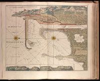
Subject (Geographic):
Atlantic Ocean--Lower Bay, Atlantic Ocean--Upper Bay, New Jersey--Sandy Hook, New York Harbor (N.Y. and N.J.) Maps--Early works to 1800., New York Region--Maps--Early works to 1800., and Sandy Hook (N.J.)
Subject (Name):
Robert Sayer and John Bennett (Firm), printmaker, printseller
Subject (Topic):
Nautical charts, Nautical charts--Hudson River Estuary (N.Y. and N.J.)--Early works to 1800., Nautical charts--Lower Bay (N.Y. and N.J.)--Early works to 1800., and Nautical charts--Upper Bay (N.Y. and N.J.)--Early works to 180
Found in:
Beinecke Rare Book and Manuscript Library > Chart of the entrance of Hudson's River, from Sandy Hook to New York [cartographic material] : with the banks, depths of water, sailing-marks, & ca.
Creator:
Published / Created:
[1536?]
Call Number:
Covers 49 +1536
Image Count:
6
Resource Type:
cartographic image
Description:
Title devised by cataloger.
Publisher:
Conte di Ottomano Freducci
Subject (Geographic):
Mediterranean Region, North Atlantic Ocean, and Baltic Sea
Subject (Topic):
Nautical charts and Maps
Found in:
Beinecke Rare Book and Manuscript Library > Composite atlas of portolan charts produced by Conte di Ottomano Freducci
Creator:
Published / Created:
[ca. 1734]
Call Number:
1973 Folio 18
Image Count:
1
Description:
BEIN 1973 Folio 18: Backed with paper. Ms. no. "10" in upper right-hand corner. Sheet measures 53.5 x 62.5 cm. No. 9 of 87 maps bound together.
Publisher:
By Gerard van Keulen
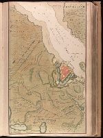
Subject (Geographic):
Wismar (Germany), Germany, and Wismar Bay
Subject (Topic):
Maps and Nautical charts
Found in:
Beinecke Rare Book and Manuscript Library > De Haven en Stad Wismar desselfs Districkt Belegering en Werken daer voor [cartographic material].
Creator:
Published / Created:
[ca. 1734?]
Call Number:
1973 Folio 18
Image Count:
1
Description:
BEIN 1973 Folio 18: Backed with paper. Ms. no. "58" in upper right-hand corner. Sheet measures 53.7 x 62.3 cm. No. 53 of 87 maps bound together.
Publisher:
By Gerard van Keulen
Subject (Geographic):
Sète (France), France, and Sète
Subject (Topic):
Maps and Nautical charts
Found in:
Beinecke Rare Book and Manuscript Library > De Haven van Cette in de Middelandse Zee in Langedoc [cartographic material].
Published / Created:
1753-81.
Call Number:
1973 Folio 103
Container / Volume:
6
Image Count:
6
Description:
BEIN: Imperfect: v. 1-2, 4-5 wanting.
Publisher:
Johannes van Keulen
Subject (Topic):
Nautical charts, Pilot guides, and Atlases
Found in:
Beinecke Rare Book and Manuscript Library > De Nieuwe groote lichtende zee-fakkel ...
Creator:
Published / Created:
[1734]
Call Number:
1973 Folio 18
Image Count:
1
Description:
BEIN 1973 Folio 18: Backed with paper. Ms. no. "13" in upper right-hand corner. Sheet measures 53.6 x 35.5 cm. No. 13 of 87 maps bound together.
Publisher:
By Gerard van Keulen ...
Subject (Geographic):
Rügen Island (Germany), Stralsund (Germany), and Baltic Sea
Subject (Topic):
Northern War, 1700-1721, Maps, and Nautical charts
Found in:
Beinecke Rare Book and Manuscript Library > De kust van Pomeren, hey eyland Rugen [cartographic material].
Creator:
Call Number:
1977 Folio 96
Collection Title:
The West-India atlas: or, A compendious description of the West-Indies: illustrated with forty
Image Count:
1
Resource Type:
Maps, Atlases & Globes
Subject (Geographic):
Jamaica
Subject (Topic):
Nautical charts
Collection Created:
London, Printed for Robert Sayer and John Bennett, Fleet-Street, 1775
Found in:
Beinecke Rare Book and Manuscript Library > Jamaica from the latest surveys; improved and engraved by Thomas Jefferys geographer to the king
Published / Created:
1703.
Call Number:
1983 Folio 53
Image Count:
12
Description:
BEIN: Beinecke copy imperfect: 6 p. of text wanting. (1983 Folio 53)
Publisher:
Chez Hubert Jaillot aux deux Globes [i.e. Pieter Mortier]
Subject (Topic):
Nautical charts and Sailing ships
Found in:
Beinecke Rare Book and Manuscript Library > Le Neptune françois, ou, Atlas nouveau des cartes marines : levées et gravées par ordre exprés du roy pour l'usage de ses armées de mer ...