Skip to search
Skip to main content
Skip to first result
Search
You Searched For
Subject (Topic)
Railroads--Maine--Maps
Search Results
Creator:
Published / Created:
[1890?]
Call Number:
761gme 1890
Container / Volume:
BRBL_00449
Image Count:
1
Resource Type:
Maps, Atlases & Globes
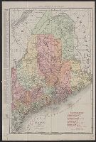
Description:
Shows Bangor and Aroostook Railroad and connecting lines.
Publisher:
Rand Avery Supply Co. ,
Subject (Name):
Bangor and Aroostook Railroad Company--Maps
Subject (Topic):
Railroads--Maine--Maps
Found in:
Beinecke Rare Book and Manuscript Library > Bangor & Aroostook Railroad and connections : including Northern Maine hunting and fishing region.
Creator:
Published / Created:
1892
Call Number:
761 R16 1892
Container / Volume:
BRBL_00449
Image Count:
1
Resource Type:
Maps, Atlases & Globes
Alternative Title:
New map of the Rangeley Lakes region and the headwaters of the Connecticut, Magalloway, Androscoggin, Sandy and Dead Rivers
Description:
"Entered according to Act of Congress in the year 1889 by Charles A.J. Farrar in the Office of the Librarian of Congress at Washington.
Publisher:
s.n.,
Subject (Geographic):
Maine--Rivers--Maps, New Hampshire--Rivers--Maps, and Rangeley Lakes (Me. and N.H.)--Maps
Subject (Topic):
Railroads--Maine--Maps and Railroads--New Hampshire--Maps
Found in:
Beinecke Rare Book and Manuscript Library > Farrar's new map of the Rangeley Lakes Region : and the headwaters of the Connecticut, Magalloway, Androscoggin, Sandy and Dead Rivers showing all railroad, state and steamboat routes. County and wood roads, hotels, camps and post offices. Corrected to Ju
Creator:
Published / Created:
c1911.
Call Number:
761gme 1911
Container / Volume:
BRBL_00449
Image Count:
1
Resource Type:
Maps, Atlases & Globes
Alternative Title:
Rand McNally & Co.'s new business atlas map of Maine. and Rand-McNally indexed atlas.
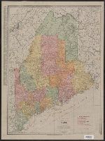
Description:
Includes key to railroads.
Publisher:
Rand, McNally & Co.,
Subject (Geographic):
Maine--Maps
Subject (Topic):
Electric lines--Maine--Maps, Railroads--Maine--Maps, and Steamboat lines--Maine--Maps
Found in:
Beinecke Rare Book and Manuscript Library > Maine / Rand McNally & Co.
Creator:
Published / Created:
1892]
Call Number:
761 M86 1892
Container / Volume:
BRBL_00448
Image Count:
2
Resource Type:
Maps, Atlases & Globes
Description:
Folded into tan wraps entitled: Map of Mt. Desert Island and the coast of Maine presented by the Maine Central Railroad and Portland-Mt. Desert & Machias Steamboat Co.
Publisher:
Boston & Maine Railroad,
Subject (Geographic):
Hancock County (Me.)--Maps and Mount Desert Island (Me.)--Maps
Subject (Topic):
Boston and Maine Railroad--Maps, Maine Central Railroad Company--Maps, Maps shelf, Portland, Mount Desert and Machias Steamboat Company, and Railroads--Maine--Maps
Found in:
Beinecke Rare Book and Manuscript Library > Map of Mount Desert Island and the coast of Maine issued by passenger department of Boston & Maine Railroad.
Creator:
Published / Created:
1895 c1891
Call Number:
761gme 1895
Container / Volume:
BRBL_00449
Image Count:
1
Resource Type:
Maps, Atlases & Globes
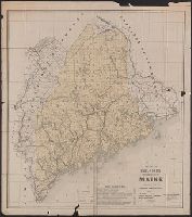
Description:
Includes list of street railroads in Maine.
Publisher:
Railroad Commissioners,
Subject (Geographic):
Maine--Maps
Subject (Name):
Burleigh & Flynt and Maine. Railroad Commissioners
Subject (Topic):
Railroads--Maine--Maps
Found in:
Beinecke Rare Book and Manuscript Library > Map of the railroads of the state of Maine : accompanying the report of the Railroad Commissioners.
Creator:
Published / Created:
c1891.
Call Number:
761gme 1891
Container / Volume:
BRBL_00449
Image Count:
1
Resource Type:
Maps, Atlases & Globes
Publisher:
Rand Avery Supply Co., Engr's. ,
Subject (Geographic):
Maine--Maps
Subject (Name):
Allen, William A., C. E, Boothby, E. A, and Robinson, H. C
Subject (Topic):
Railroads--Maine--Maps
Found in:
Beinecke Rare Book and Manuscript Library > Map of the railroads of the state of Maine accompanying the report of the railroad commissioners, 1892 / prepared for the Board of Railroad Commissioners under the direction of William A. Allen ; H.C. Robinson, E.A. Boothby, draughtsmen.
Creator:
Published / Created:
1915
Call Number:
761 1915
Container / Volume:
BRBL_00448
Image Count:
2
Resource Type:
Maps, Atlases & Globes
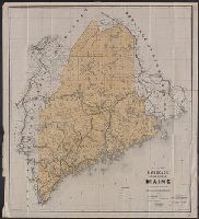
Description:
Indicates railroads, electric lines and steamship lines.
Publisher:
Rand McNally,
Subject (Geographic):
Maine--Maps
Subject (Topic):
Electric lines--Maine--Maps, Railroads--Maine--Maps, and Steamboat lines--Maine--Maps
Found in:
Beinecke Rare Book and Manuscript Library > The Rand McNally new commercial atlas map of Maine / Rand McNally & Company.