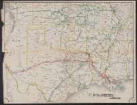
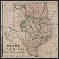
Map of the Texas & Pacific Railway and connections, Map of the Texas and Pacific Railway and connections, Texas & Pacific Railway and connections, and Texas and Pacific Railway and connections
Description:
Relief shown by hachures. and Shows Texas & Pacific Railway in red.
Publisher:
s.n.,
Subject (Name):
Texas & Pacific Railway--Maps
Subject (Topic):
Railroads--Southwestern States--Maps and Railroads--Texas--Maps
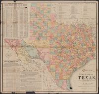
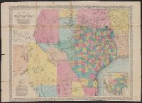
Copyright: Rand, McNally & Co., Includes tables of taxable property and rainfall measures, list of railway lines, and text of state finances., Relief shown by hachures., and Shows counties and railroads.
Publisher:
Rand, McNally & Co.,
Subject (Geographic):
Texas--Administrative and political divisions--Maps and Texas--Maps
Subject (Name):
Spaight, A. W and Texas. Dept. of Agriculture, Insurance, Statistics and History. Resources, soil, and climate of Texas
Houston and Texas Central Railway and State of Texas
Description:
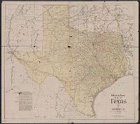
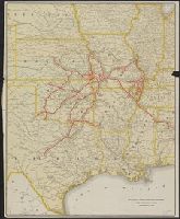
"A--12-17-77--5 M.", "Compiled from the official county maps of the general land office, and actual survey, From the Streeter collection., and Text, distance list, and ill. of "Side view, capitol at Austin, Texas" and "Tide water connection at Houston" on verso.
Publisher:
Houston & Texas Central R.R.,
Subject (Geographic):
Texas--Maps
Subject (Name):
Houston & Texas Central Railway Company and Streeter, Thomas W.--(Thomas Winthrop),--1883-1965--Ownership
Subject (Topic):
Railroad land grants--Texas--Maps and Railroads--Texas--Maps
Map showing the proposed route of the Aransas railroad (and its) connections with the eastern roads. and Texas almanac for ...
Description:
"Compiled from government surveys and other authentic documents ... engraved expressly for the Texas almanac.", "Entered according to act of congress in the, Prime meridians: Greenwich and Washington., Relief shown by hachures., and Shows counties and railroads.
Publisher:
Charles Desilver,
Subject (Geographic):
Mexico, North--Maps, Texas--Administrative and political divisions--Maps, and Texas--Maps
Subject (Name):
Desilver, Charles and Richardson, Willard, 1802-1875
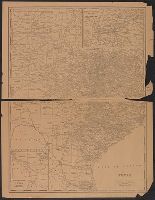
Map showing the proposed route of the Aransas railroad (and its) connections with the eastern roads., New map of the state of Texas, including part of Mexico, Richardsons' new map of Texas, State of Texas, including part of Mexico, and Texas almanac for ...
Description:
"Compiled from government surveys and other authentic documents.", "Engraved expressly for the Texas Almanac.", Includes te, and Inset: Map showing the proposed route of the Aransas railroad (and its) connections with the eastern roads. Scale [ca. 1:19,500,000].
Publisher:
Charles Desilver,
Subject (Geographic):
Mexico, North--Maps, Texas--Administrative and political divisions--Maps, and Texas--Maps
Subject (Name):
Desilver, Charles, Richardson, Willard, 1802-1875, and Wickeland, H
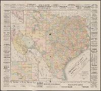
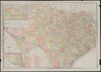
Copyright: Dun & Bradstreet., Insets: Dallas, Ft. Worth and vicinity. Scale [ca. 1:1,250,000] -- Western part of Texas. Scale [ca. 1:3,500,000]., Shows railroads., and Text and index to reporting offices on verso.