Search
You Searched For
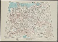
Search Results
- Creator:
- United States. Army Map Service
- Published / Created:
- 1945
- Call Number:
- 36gm 1945
- Container / Volume:
- BRBL_00130
- Image Count:
- 1
- Resource Type:
- Maps, Atlases & Globes
- Alternative Title:
- [Series] 6201
A.M.S. 6201
- Description:
- "Lambert conical orthomorphic projection."
- Subject (Topic):
- Transportation--Germany--Maps
- Found in:
- Beinecke Rare Book and Manuscript Library > Germany : special strategic map.