Search
You Searched For
Search Results
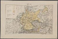
- Published / Created:
- [1875?]
- Call Number:
- 304 1875
- Container / Volume:
- BRBL_00034
- Image Count:
- 1
- Resource Type:
- Maps, Atlases & Globes
- Publisher:
- Lanée Seur de Longuet,
- Subject (Geographic):
- Europe, Central--Maps
- Found in:
- Beinecke Rare Book and Manuscript Library > Europe Centrale.
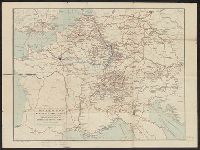
- Creator:
- Handtke, F. (Friedrich), 1815-1879
- Published / Created:
- [1867?].
- Call Number:
- 304 1867
- Container / Volume:
- BRBL_00033
- Image Count:
- 1
- Resource Type:
- Maps, Atlases & Globes
- Description:
- 304 1867: Hand col. and No. 36 and No. 37.
- Publisher:
- Flemming,
- Subject (Geographic):
- Europe, Central--Maps
- Found in:
- Beinecke Rare Book and Manuscript Library > F. Handtke's Special-Karte von Mittel-Europa / F. Handtke.
- Published / Created:
- [1945?]
- Call Number:
- 50 1945J
- Container / Volume:
- BRBL_00273
- Image Count:
- 2
- Resource Type:
- Maps, Atlases & Globes
- Alternative Title:
- [Map of Central Europe]
- Description:
- Cloth map.
- Publisher:
- Air Ministry,
- Subject (Geographic):
- Europe, Central--Maps and France--Maps
- Found in:
- Beinecke Rare Book and Manuscript Library > France.
- Published / Created:
- 1915
- Call Number:
- 304f 1915
- Container / Volume:
- BRBL_00034A
- Image Count:
- 1
- Resource Type:
- Maps, Atlases & Globes
- Publisher:
- dell' Editore Antonio Vallardi,
- Subject (Geographic):
- Europe, Central--Maps
- Found in:
- Beinecke Rare Book and Manuscript Library > Frontiera Italo-Austriaca e Territori della "Piu Grande Italia".
- Published / Created:
- 1876
- Call Number:
- 41 K14 1876
- Container / Volume:
- BRBL_00242
- Image Count:
- 4
- Resource Type:
- Maps, Atlases & Globes
- Description:
- Tables of various data in margins.
- Publisher:
- K.K. Militaerischen Geografischen Institute,
- Subject (Geographic):
- Europe, Central--Maps
- Found in:
- Beinecke Rare Book and Manuscript Library > General Karte der Herzogthümer Kärnten und Krain, der Gefürsteten Grafschaft Görz und Gradiska, der Markgrafschaft Istrien, der reichsunmittelbaren Stadt Triest sammt ihrem Gebiete und des königlich ungarischen Küstenlandes.
- Published / Created:
- 1919]
- Call Number:
- 11hcf 1919B-16
- Container / Volume:
- BRBL_00010O
- Image Count:
- 1
- Resource Type:
- Maps, Atlases & Globes
- Description:
- Ms. notes of changed political boundaries following the first World War.
- Publisher:
- s.n.,
- Subject (Geographic):
- Europe, Central--Maps and Germany--Maps
- Subject (Topic):
- Boundaries--Europe, Central--Maps and World War, 1914-1918--Europe, Central--Maps
- Found in:
- Beinecke Rare Book and Manuscript Library > Germany.
- Published / Created:
- 1919]
- Call Number:
- 11hcf 1919B-22
- Container / Volume:
- BRBL_00010P
- Image Count:
- 1
- Resource Type:
- Maps, Atlases & Globes
- Publisher:
- s.n.,
- Subject (Geographic):
- Europe, Central--Maps
- Found in:
- Beinecke Rare Book and Manuscript Library > Germany.
- Creator:
- Gaze, Henry, & sons
John Bartholomew and Son
- Published / Created:
- [1920?]
- Call Number:
- 304ag 1920A
- Container / Volume:
- BRBL_00034A
- Image Count:
- 2
- Resource Type:
- Maps, Atlases & Globes
- Alternative Title:
- Map of Central Europe indicating the principal routes
- Publisher:
- H. Gaze & Sons,
- Subject (Geographic):
- Europe, Central--Maps
- Subject (Topic):
- Roads--Europe, Central--Maps
- Found in:
- Beinecke Rare Book and Manuscript Library > H. gaze & sons : map of central Europe, indicating the principal routes comprised in their system of continental travel tickets.
- Published / Created:
- [1915?]
- Call Number:
- 304gmb 1915
- Container / Volume:
- BRBL_00034B
- Image Count:
- 1
- Resource Type:
- Maps, Atlases & Globes
- Alternative Title:
- Ravensteins deutsche Kriegskarten 2 and Ravensteins Kriegskarte 2
- Publisher:
- Ravenstein
- Subject (Geographic):
- Europe, Central--Maps
- Found in:
- Beinecke Rare Book and Manuscript Library > Karte der Kriegs- und Heeresstrassen in Deutschland, Österreich, OstFrankreich, Schweiz, Belgien, Holland, Ober-Italien und Russisch-Polen.